
OUR COURSES
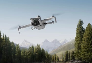
Enterprise Drone Essentials
RM3,900 / 4 days
Our comprehensive curriculum goes beyond simple drone operation. Starting with basic knowledge the DJI Enterprise system, participants will delve deep into the functionalities of the DJI Pilot 2. This will equip learners with the skills to maximize the software’s potential, improving drone piloting proficiency. The course incorporates hands-on exercises, which include manual flying and automated flight missions preparation. These practical sessions will focus on the fundamental operations in aerial mapping. Post-processing software such as DJI Terra and Global Mapper Pro will be introduced for the generation of orthomosaic 2D maps and terrain models.
WHAT YOU WILL LEARN
Basic Flying Skills
Introduction to UAS Ecosystem
Fight Safety & Regulation
Controlling & Manuevering Practice
Drone Systems and Flight Operation
Emergency Procedures
Industrial Application Training
Basic Knowledge of Aerial Mapping
Flight Route Mission Planning
Field Data Acquisition
Photogrammetry Data Processing
Easy Fly
RM499 / 1 day
This individualized training program covers basic operation of UAV and its flight safety. You will get to learn all kind of settings in the DJI Pilot App Proper installation of propellers and batteries, remote controller pairing and pre-flight check will be covered. The course also allows you to master a variety of complex camera moves operating techniques and learn more about intelligent flight modes such as FocusTrack, Quickshots and Mastershots. Post-video editing will be taught towards the end of the course.
WHAT YOU WILL LEARN
Theoretical Knowledge
Introduction to Aerial Photography
Flight Safety
Pre-flight Check
Drone Maintenance and Care
DJI Fly App (Flight Software)
DJI Light Cut App (post-video editing)
Practical Session
Basic Drone Operation
Hands-on pre-flight check
Basic Camera Movement and Composition
Intelligent Features
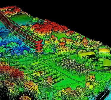
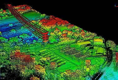
LiDAR Mapping
RM4,900 / 4 days
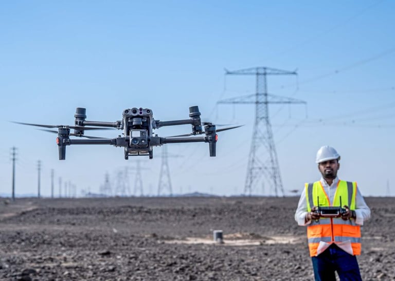
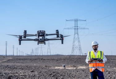
UAS Inspection
RM4,900 / 4 days
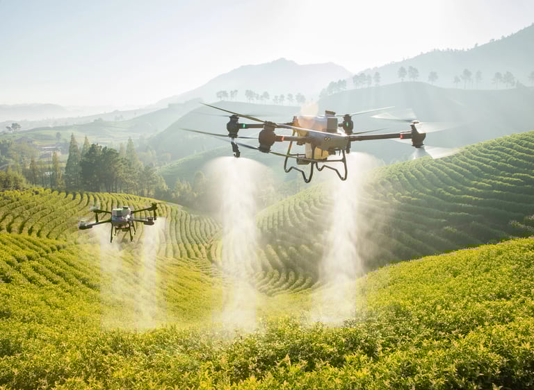
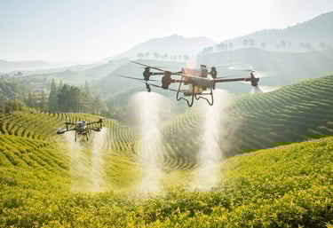
Agriculture Drone Operation
RM2,900 / 3 days
Master the art of acquiring high-quality LiDAR point cloud data, coupled with advanced post-processing techniques. Our course equips participants with the skills needed to efficiently capture Lidar data, ensuring accuracy and precision in mapping applications. Dive into the intricacies of LiDAR technology, understand data acquisition methodologies, and hone your expertise in post-processing to generate insightful and reliable geospatial information.
WHAT YOU WILL LEARN
Basic Skill Training
Fight Safety & Regulation
Maintenance Practice
Drone System and Flight Operation with DJI Matrice 350 & Zenmuse L2
Emergency Procedures
LiDAR Application
Introduction to LiDAR Mapping & Survey
Terminology of Aerial Mapping
Flight Route Mission Planning
Field Data Acquisition
LiDAR Point Cloud Processing
Deliverables Preparation
Manual inspections are inefficient, costly, and risky in certain conditions. Drones equipped with infrared or zoom cameras are excellent alternatives to manual inspection, especially on long-distance mission and potentially dangerous hard-to-reach areas. This course was developed for corporations and professionals who want to be a certified pilot in the drone inspection industry such as electricity facilities, forests, oil pipelines, as well as environmental protection and security surveillance.
WHAT YOU WILL LEARN
Basic Skill Training
Flight Safety Education
Controlling Practice
Introduction to UAS
UAS Assembly
UAS Categories
Use and Maintenance of Mission Equipment
Inspection Skills
Panoramic Videography
Capturing Photo/Video from Multiple Angles
Automated Flight Mission
Beyond-Visual-Range (BVR) Inspection
Analysis and Processing of Infrared Data
Standard Camera
The popularity of agriculture drones is on the rise, and our training program addresses the growing demand by providing essential skills for operating agricultural spraying drones safely and confidently. Our program is designed to equip aspiring drone pilots with the essential skills and knowledge needed to excel in the dynamic field of agricultural drone operations, while adhering to safety standards.
WHAT YOU WILL LEARN
Agriculture Drone Components & Software
Remote Controller Software
Hardware Care and Maintenance
Spraying System Introduction
Mission Planning
Aerial Mapping Introduction
Introduction to Georeferencing (RTK base station)
Flight Route Planning
Agriculture Drone Flight Execution
All listed drone training course fees are charged on a per-participant basis.
Upcoming Course Schedule
Contact Us for Latest Course Dates and Customised Training
REMOTE PILOT CERTIFICATE OF COMPETENCY (RCOC-B)*
22-26 June 2026
10-14 August 2026
12-16 October 2026
14-18 December 2026
____________________________________________________________________________________________________________________
ALL OTHER COURSES
Please contact us for course arrangement.
____________________________________________________________________________________________________________________
*Please note that training dates are subject to change or cancellation depending on class size or unforeseen circumstances.
Get in Touch with Our Drone Experts
Phone
djisarawak@droneskaki.com
+6011-6228 6888 (Kuching)
+6011-6868 0028 (Miri)
© 2026 DJI Academy Sarawak.
address
1st Floor, Lot 8677, Jalan Pending, Pending Commercial Centre, 93450 Kuching, Sarawak
Questions about courses or bookings? Reach out anytime, we're here to help.